

World Physical Active Learning Wall Map


World Physical Active Learning Wall Map
Buying for a school, company or government department? Request a quote and order on invoice.
Wall Map · est. 1958
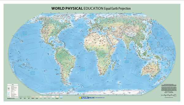
The World Physical Active Learning Wall Map shows the world's relief, rivers, deserts and seas with the names printed on the map rather than left to a key — on a sheet 1.2 metres wide.
Mountains are named individually with their heights: Qomolangma Feng (Mt Everest) at 8 850 metres, Qogir Feng (K2) at 8 611, Kilimanjaro at 5 895, Mont Blanc at 4 807, Ras Dashen at 4 620, Mount Cameroon at 4 100. The ranges are named too — the Alps, Pyrenees, Carpathians, Caucasus, Atlas Mountains, Himalayas, Altai, the Western and Eastern Ghats, the Ethiopian Highlands and the Deccan Plateau among them.
Deserts are named and shaded, from the Sahara and the Grand Erg Occidental to the Libyan, Nubian, Arabian, Taklimakan and Gobi. Rivers, lakes, seas, gulfs, bays, capes and island groups all carry their names, with relief shading behind them.
Suitable for
Geography classrooms. Relief, drainage and desert distribution with the names on the map — the physical geography syllabus without a separate key to work through.
Training rooms and field briefings. The terrain and river systems that operational maps leave out, at a size a room can read together.
Homes and studies. A physical world map is the one people actually stand and look at.
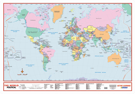
Pairs with the political sheet. The World Political Educational Wall Map covers countries and capitals in the same series.
Not the right map if you need borders and capitals. This is a physical map — relief, water and landform names, not political boundaries.
Specification
- Map Size
- 1200 × 700 mm
Every sheet researched, compiled and updated in South Africa.
Buying this map
- Format
- Ready to Hang comes with a plastic batten fixed along the top and bottom, so a large sheet hangs flat and straight as soon as it is up. Laminated Sheet is the same laminated map without the battens.
- Delivery
- Delivery anywhere in South Africa is R250 for wall maps — one flat fee for the order, not per map, so a set of sheets costs the same to deliver as one. Orders are dispatched within 2 working days of payment; allow 3 to 5 working days for delivery.
Schools, companies and government
Order on invoice, or ask for a quote.
If your organisation needs a formal quotation or pays on invoice, skip the card checkout. Tell us the quantity and finish and we will send a quote within one working day.
- A formal quotation you can put through procurement, with our VAT and banking details.
- One quote for the lot — a set of provincial sheets, or one map for every classroom.
- Payment by EFT or purchase order. Your order number goes on the invoice.
Quotes are handled by Louise Lumb in Cape Town — +27 79 462 1260 if you would rather talk it through.
Quote for World Physical Active Learning Wall Map · from R 1,950.00