

World Physical Educational Wall Map (Equal Earth)


World Physical Educational Wall Map (Equal Earth)
Buying for a school, company or government department? Request a quote and order on invoice.
Wall Map · 1st edition · est. 1958
Named in the UN's Correct the Map resolution. On 4 September 2026 the General Assembly voted 164–1, on a resolution brought by the African Union, to encourage equal-area projections such as Equal Earth wherever the relative size of countries and continents matters. What the vote actually changed
A physical world map on the Equal Earth projection at 1:30 300 000, printed 1 475mm wide.
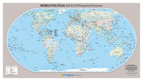
The Equal Earth projection shows land areas and oceans at their true sizes relative to each other. The rounded map sides suggest the spherical form of the Earth, and straight parallels allow latitude to be compared easily across the sheet. Africa appears fourteen times larger than Greenland — as it actually is.
Continents are named, and physical features are carried across the whole sheet. Peaks are named with their heights in metres. Major rivers, major lakes, dams and pans are shown, and waterfalls are named and symbolised. Coastal points and islands are named, oceans, seas, bays and straits are labelled, and undersea features are shown rather than left as flat blue. Capital cities, major cities and towns are marked, and latitude and longitude lines are drawn in degrees.
Suitable for
Geography classrooms. Terrain, rivers, lakes, waterfalls and undersea features on an equal-area projection, so continental land masses compare truthfully.
Teaching the projection itself. The sheet is a working example of how map projections change what a map appears to say.
Reference and briefing rooms. Physical geography above and below sea level on a single 1 475mm sheet.
For political geography instead. The companion sheet, the World Political Educational Wall Map (Equal Earth), carries country and dependency names on the same projection and scale.
Specification
- Scale
- 1:30 300 000
- Edition
- 1st
- Map Size
- 1475 × 841 mm
- ISBN
- 9781776170975
Every sheet researched, compiled and updated in South Africa.
Buying this map
- Format
- Ready to Hang comes with a plastic batten fixed along the top and bottom, so a large sheet hangs flat and straight as soon as it is up. Laminated Sheet is the same laminated map without the battens.
- Delivery
- Delivery anywhere in South Africa is R250 for wall maps — one flat fee for the order, not per map, so a set of sheets costs the same to deliver as one. Orders are dispatched within 2 working days of payment; allow 3 to 5 working days for delivery.
Schools, companies and government
Order on invoice, or ask for a quote.
If your organisation needs a formal quotation or pays on invoice, skip the card checkout. Tell us the quantity and finish and we will send a quote within one working day.
- A formal quotation you can put through procurement, with our VAT and banking details.
- One quote for the lot — a set of provincial sheets, or one map for every classroom.
- Payment by EFT or purchase order. Your order number goes on the invoice.
Quotes are handled by Louise Lumb in Cape Town — +27 79 462 1260 if you would rather talk it through.
Quote for World Physical Educational Wall Map (Equal Earth) · from R 2,450.00