

Africa Commercial Wall Map


Africa Commercial Wall Map
Buying for a school, company or government department? Request a quote and order on invoice.
Wall Map · 3rd edition · est. 1958
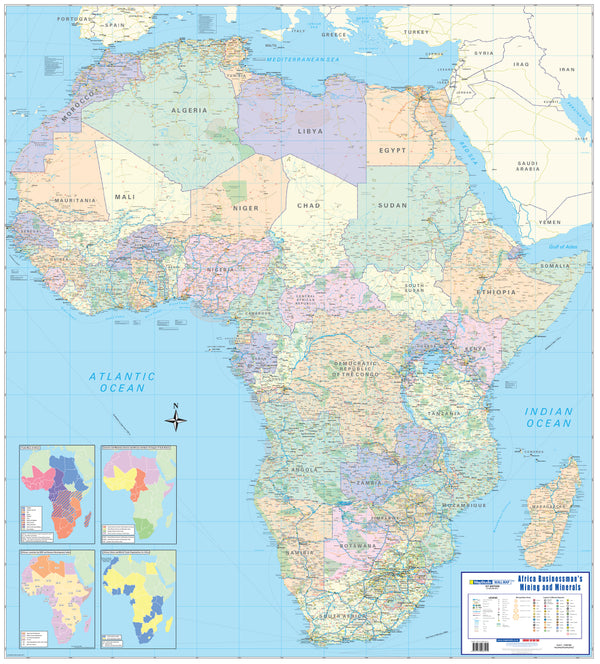
The Africa Commercial Wall Map shows the whole continent at 1:8 000 000 on an A0 sheet, drawn on the Miller Oblated projection with full relief colouring and sea-floor depths.
Cities are graded by population and the legend prints the bands: over five million, one to five million, 200 000 to a million, 100 000 to 200 000, 25 000 to 100 000, 10 000 to 25 000, and fewer than 10 000. National capitals are picked out separately, and territories administered by or belonging to another country are labelled with it.
Boundaries are drawn at three levels — international, state, and disputed or undefined — so contested ground appears as contested rather than settled. Roads are graded from major through minor to seasonal, railways from major to minor, and international airports are distinguished from national ones. Relief is coloured, with the highest peak on the continent, the highest peak in each country, every mountain above 5 000 metres and other named summits marked; sea-floor depth figures come from British Oceanographic Data Centre bathymetry.
Suitable for
Trade, export and market planning. Cities are graded into seven population bands with the thresholds printed in the legend, so the size of a place can be read off the map rather than looked up.
Risk, policy and compliance work. Disputed and undefined boundaries are drawn as such rather than resolved to one side, and dependent territories are labelled with the country that administers them.
Boardrooms and reception areas. Full relief colouring, named peaks and a clean political palette make this a sheet that reads well from across a room.
Classrooms and training rooms. Relief, elevations, sea depths and population-graded settlement on one sheet, on a stated projection.
Not the right map if you need road distances. This sheet grades roads but does not print inter-town distances or border posts. For a road-oriented continental map, see the Africa Executive Political Wall Map.
Specification
- Scale
- 1:8 000 000
- Edition
- 3rd
- Map Size
- 840 × 1190 mm, A0
- ISBN
- 9781770266179
Every sheet researched, compiled and updated in South Africa.
Buying this map
- Format
- Ready to Hang comes with a plastic batten fixed along the top and bottom, so a large sheet hangs flat and straight as soon as it is up. Laminated Sheet is the same laminated map without the battens.
- Delivery
- Delivery anywhere in South Africa is R250 for wall maps — one flat fee for the order, not per map, so a set of sheets costs the same to deliver as one. Orders are dispatched within 2 working days of payment; allow 3 to 5 working days for delivery.
Related
You might also like

Schools, companies and government
Order on invoice, or ask for a quote.
If your organisation needs a formal quotation or pays on invoice, skip the card checkout. Tell us the quantity and finish and we will send a quote within one working day.
- A formal quotation you can put through procurement, with our VAT and banking details.
- One quote for the lot — a set of provincial sheets, or one map for every classroom.
- Payment by EFT or purchase order. Your order number goes on the invoice.
Quotes are handled by Louise Lumb in Cape Town — +27 79 462 1260 if you would rather talk it through.
Quote for Africa Commercial Wall Map · from R 2,450.00